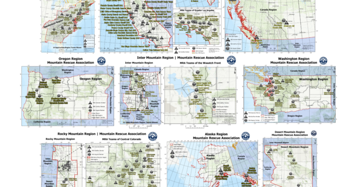
The MRA recently completed a newly plotted series of maps detailing the entire Mountain Rescue Association network of regions and teams. Seeing our regions plotted out really drives home the scale of the organization we are all a part of.
The MRA is a national organization, encompassing nine regions that span two countries and 32 states. By structuring our general business across these distinct regions, the MRA provides a unified national voice and certification for 137 affiliated member teams, ensuring we are represented. Putting this data onto maps helps visualize just how expansive the Mountain Rescue community and reach has become; and now we now have a set of maps that display every region and every team, the full footprint of our shared mission can be displayed to others easier.
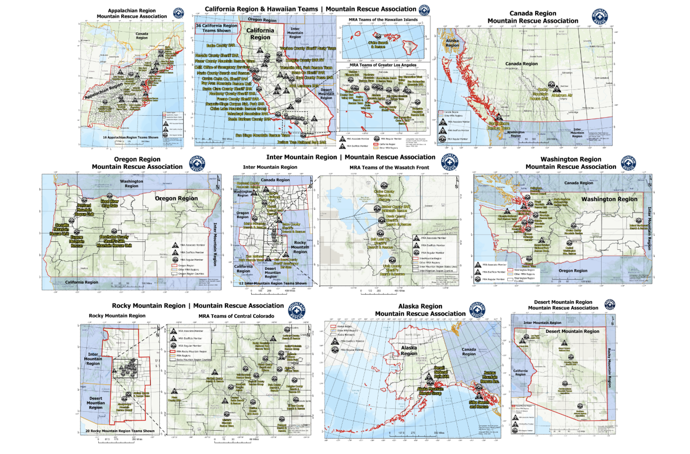
Maps of regions and teams.
This mapping project features individual, dedicated maps for every single region, as well as a large-format plot that captures all teams and regions across the MRA on one comprehensive map.
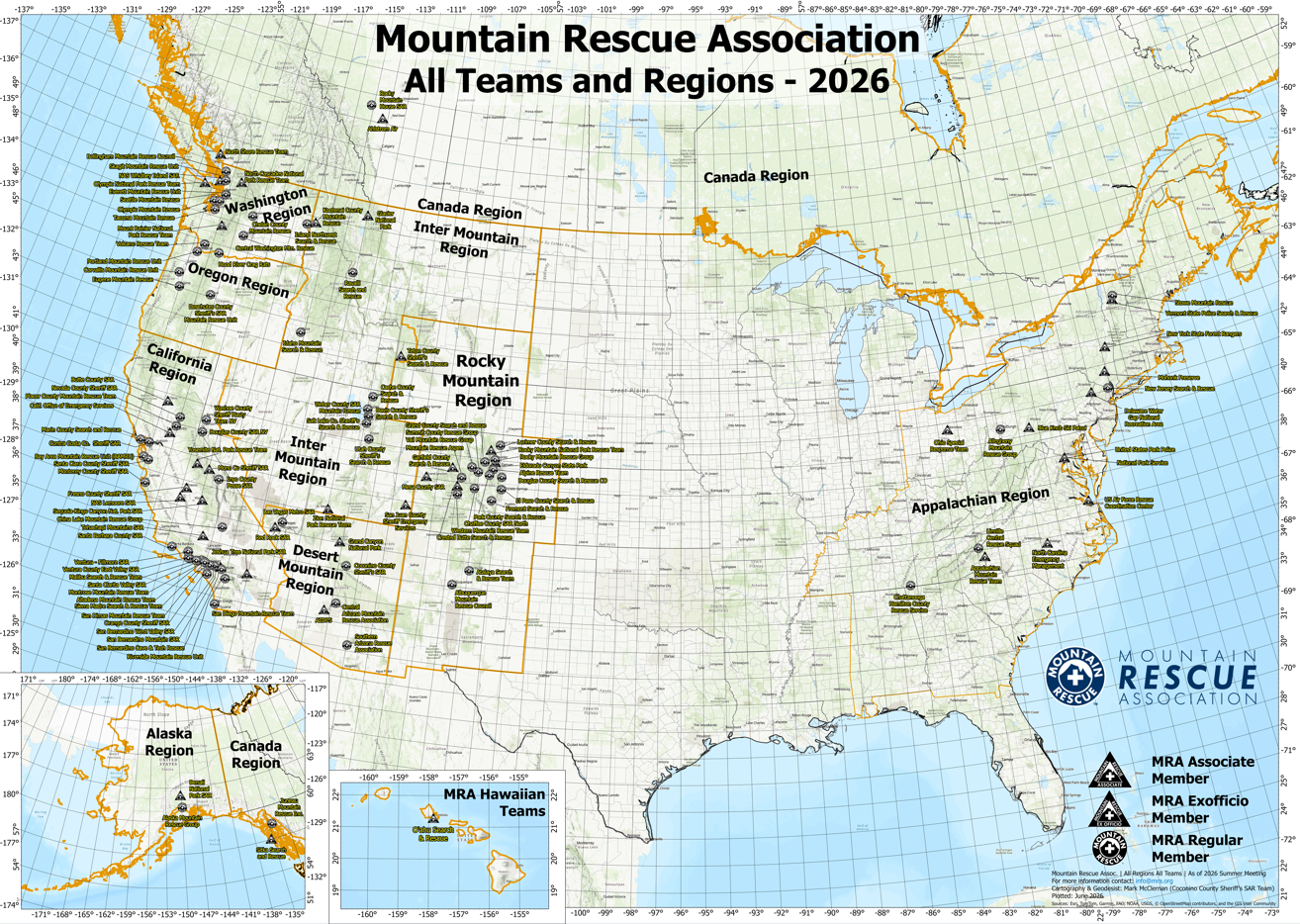
The current nine MRA region boundaries and 137 MRA member and affiliated teams.
The exact geographic breakdown of our MRA’s and boundaries are formally defined by our organizational guidelines. According to the official Mountain Rescue Association Policies document (MRA Policies June 2019), the specific states, counties, and territories incorporated into each of our operational regions are outlined below:
The Alaska Region covers Alaska, while the Appalachian Region includes Maine, New Hampshire, Vermont, Massachusetts, Rhode Island, Connecticut, New York, New Jersey, Pennsylvania, Delaware, Maryland, Virginia, West Virginia, North Carolina, South Carolina, Georgia, Alabama, Tennessee, Kentucky, and Ohio. The California Region encompasses California alongside specific Nevada counties, including Carson City, Douglas, Esmeralda, Lyon, Mineral, Storey, and Washoe. The Desert Mountain Region covers Arizona and Clark County, Nevada. The Inter-Mountain Region includes Idaho, Montana, Utah, Teton County in Wyoming, and the remaining parts of Nevada not covered by other regions. The Oregon Region covers Oregon, and the Washington Region covers Washington. Finally, the Rocky Mountain Region includes Colorado, New Mexico, and Wyoming, excluding Teton County.
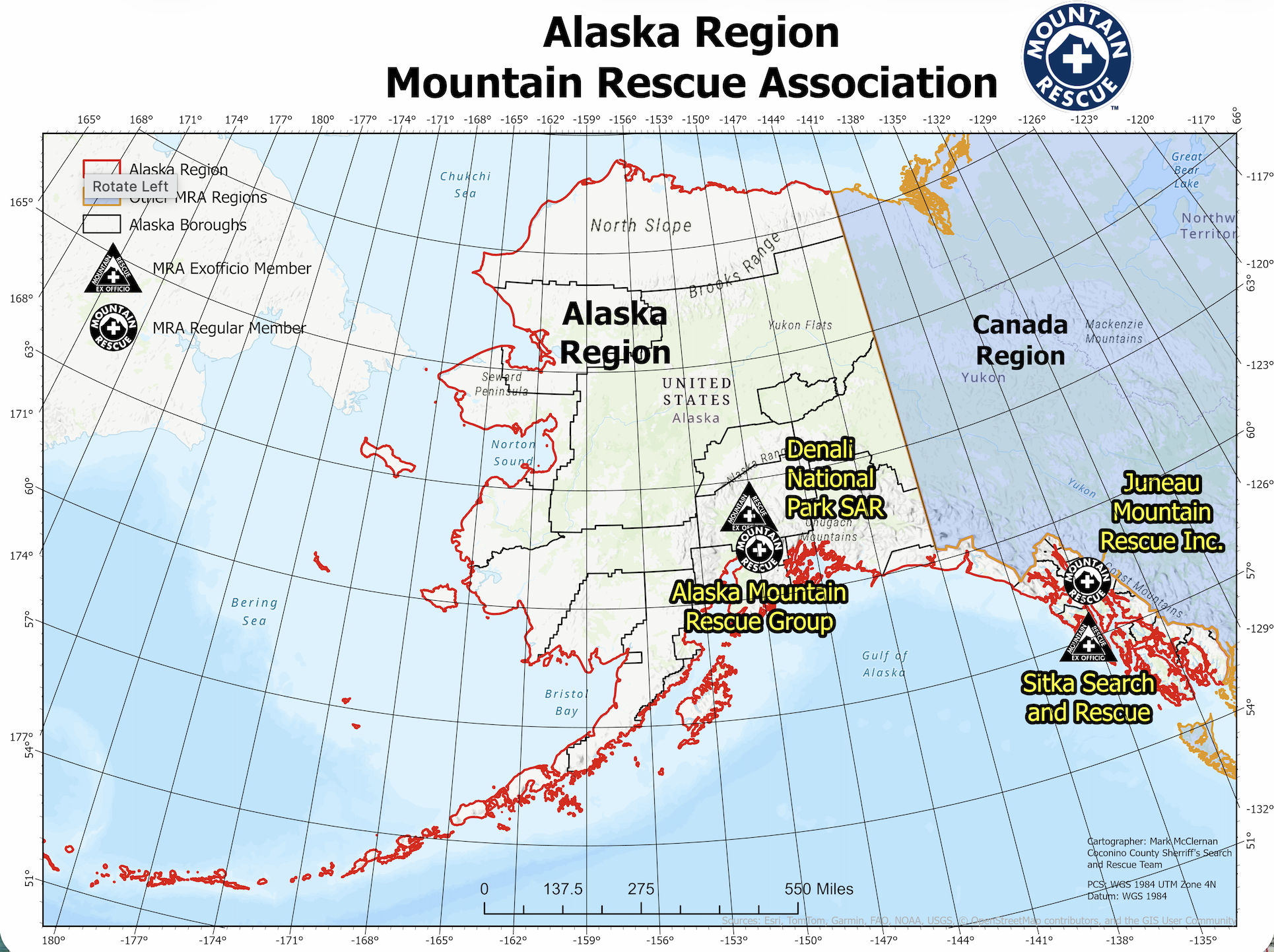

Moving forward, ensuring these maps stay current and available is highly valuable to the MRA and its membership. To support this effort, the maps, along with the underlying ArcGIS project and data files, have been provided to the new MRA GIS group and made accessible to the organization as a whole. This new GIS team is being led by under the MRA Statistics Working Group. It is my hope that this transition will allow the maps to be continuously updated alongside each regional meeting and as future membership changes occur.
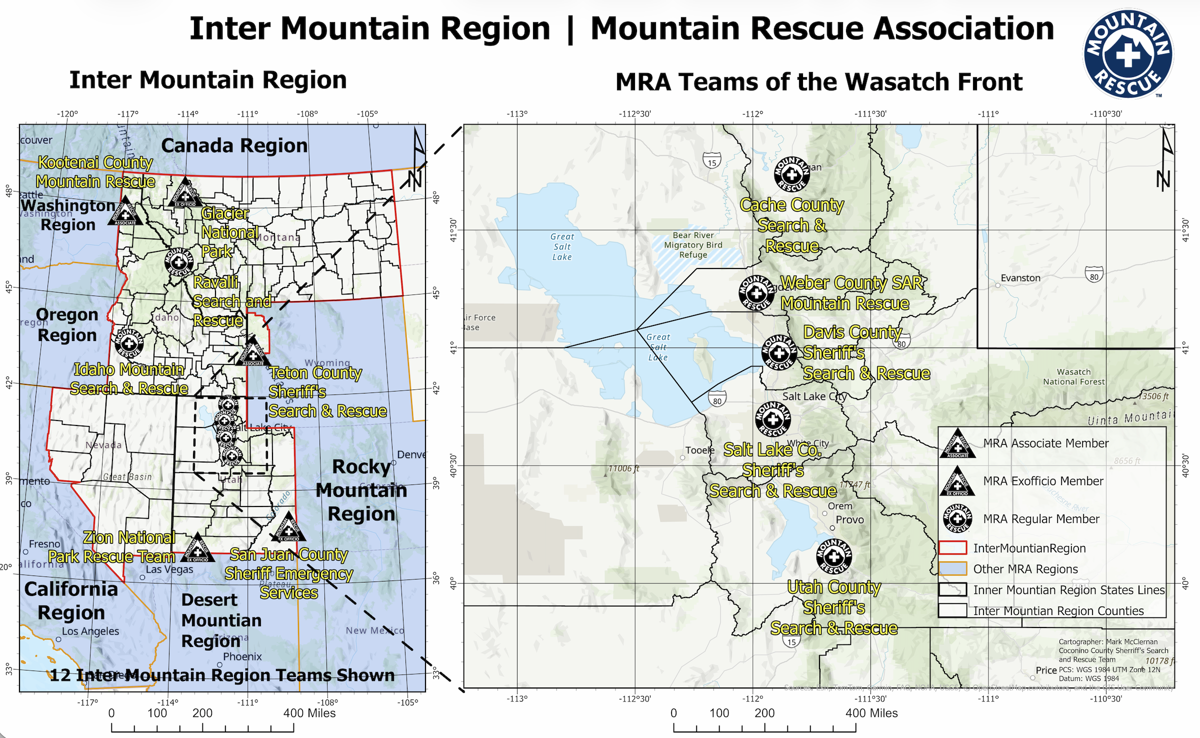
Inter Mountain Region Map
Keeping our maps accurate means reflecting the most recent changes in our membership, especially following the Summer 2026 business meeting. The latest data includes a few notable updates. We want to say Aloha and welcome to the MRA’s first Hawaiian team, Oahu Search and Rescue, joining as a new associate member. The maps also reflect the recent loss of Tonto Rim as of Summer 2026, alongside a few other early departures from previous years.
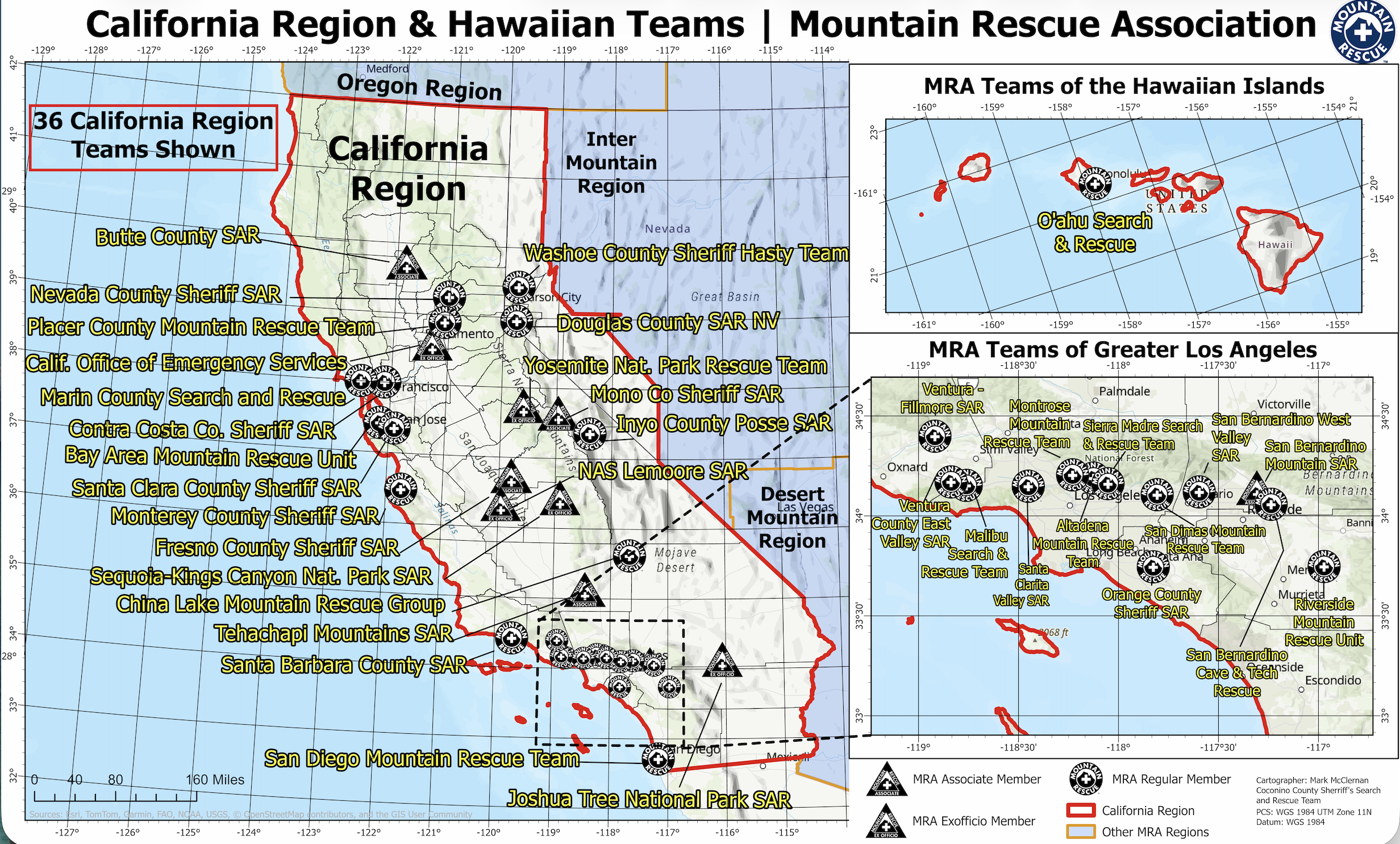 The finalized maps and the ArcGIS data files have been made fully available to the MRA Board and, with limited scope of access, to all MRA members. If you need the maps or the underlying data for a specific use case to support your team, such as plotting localized data, generating figures for grant writing, or fulfilling a direct regional requirement, please speak to your region or myself for access. These data can be accessed directly with a MRA email address.
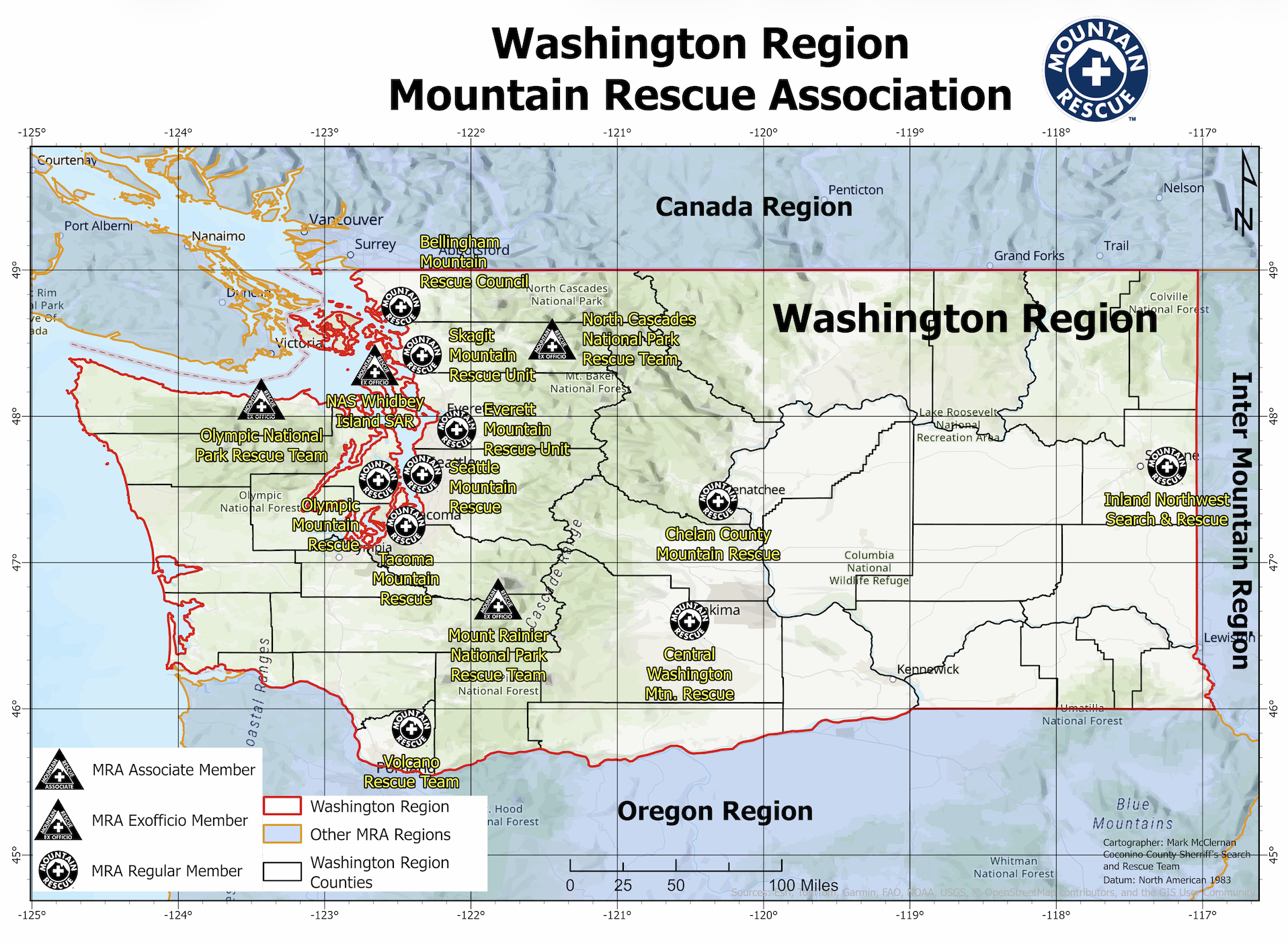
Washington Region Map
Assembling this volume of spatial data took time, and while every effort was made to ensure accuracy, there may be errors. If you spot something that needs correcting, or if you have any general feedback, please reach out to comms@mra.org for any comments, changes, or corrections. Below are links to all the maps:
Thanks to Dawn Wilson for inspiring this project and the MRA Board for its support. Thanks to Molly Williams for help with this Meridian article.
Mark McClernan is the MRA communications working group lead and a Geodesist with NOAA’s National Geodetic Survey and is passionate about geology and geography. Mark began SAR volunteering in 2012 and has been a member of the Coconino County Sheriff’s Search and Rescue Team, Western Mountain Rescue Team, and Alpine Rescue Team.